MTB Project Logo

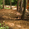
A long, rocky downhill singletrack trail used in many motorcycle events but still fun on a bike.


Your Rating: Rating Rating Rating Rating Rating      Clear Rating
Your Difficulty:
Your Favorites: Add To-Do · Your List
Zoom in to see details
Map Key

2.1

Miles

3.3

KM

Singletrack

2,043' 623 m

High

1,633' 498 m

Low

263' 80 m

Up

421' 128 m

Down

6%

Avg Grade (4°)

20%

Max Grade (11°)

Dogs Unknown

E-Bikes Allowed

This trail is downhill only.

Description

This trail used to start in a gutter to conceal it, but the route was eventually discovered by the local motorcycle club, and has been used on many races. It now starts 100' north of the gutter and is marked by a 4X4 signpost. Half way down, turn right and continue downhill along the fence for 100 yards then turn sharply right back into the woods.

After reaching the bottom of a steep downhill either: 1) turn left downhill to the edge of a stream and then sharply right through Rhododendron over some big rocks, or 2) turn right uphill around the rhododendron. From the end of either option, you'll need to follow the trail along the stream to its end on Birch Run Road.

Contacts

Land Manager: PA DCNR - Main Office

Shared By:

Larry Boyler

Trail Ratings

  3.0 from 1 vote

#26955

Overall
  3.0 from 1 vote
5 Star
0%
4 Star
0%
3 Star
100%
2 Star
0%
1 Star
0%
Trail Rankings

#951

in Pennsylvania

#26,955

Overall
1 Views Last Month
261 Since Aug 28, 2016
Difficult Difficult

0%
0%
0%
0%
100%
0%

0 Comments

Weather


Current Trail Conditions

Unknown
Add Your Check-In

Check-Ins

none
Welcome

Join the Community

Create your FREE account today!
Already have an account? Login to close this notice.

Get Started