
 Continue with onX Maps
 Continue with Facebook


 Easy
Easy

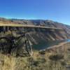
“A quick trail used primarily to access the Luck Peak Area. ”


1.7
Miles2.8
KMDoubletrack
 Easy
Easy
 Danskins Tour
14.2 mi 22.9 km • 2,008' Up 612.17 m Up • 2,015' Down 614.08 m Down

 Red Cliffs to Sidewinder to Hulls
6.5 mi 10.4 km • 1,064' Up 324.4 m Up • 1,064' Down 324.16 m Down
 Boise, ID
 Hulls Gulch Loop
7.9 mi 12.7 km • 869' Up 264.74 m Up • 869' Down 264.74 m Down
Boise, ID
Double D
17.7 mi 28.5 km • 2,596' Up 791.12 m Up • 2,594' Down 790.71 m Down
Boise, ID
 Dry Creek to Shingle Creek then Descend Dry Creek
14.1 mi 22.7 km • 2,211' Up 673.96 m Up • 2,212' Down 674.2 m Down
Boise, ID
Around the Mountain
10.2 mi 16.4 km • 1,093' Up 333.22 m Up • 1,092' Down 332.94 m Down
Boise, ID


0 Comments