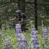
“Traversing route on the slopes above Davis Gulch Road. ”
1.5
Miles2.4
KMSingletrack

Land Manager: USFS - Helena National Forest Office
 Rodney Ridge: Top of the World to Rent Money
7.7 mi 12.4 km • 1,058' Up 322.63 m Up • 1,096' Down 334 m Down


 Helena, MT
 Mt Helena Ridge Ride
7.9 mi 12.7 km • 874' Up 266.25 m Up • 1,706' Down 520.1 m Down


 Helena…, MT
 Unravel the Scratchgravel Route
5.5 mi 8.9 km • 586' Up 178.73 m Up • 584' Down 177.99 m Down


 Helena…, MT
 MacDonald Pass
6.8 mi 11.0 km • 666' Up 202.98 m Up • 2,299' Down 700.66 m Down


 Helena…, MT
 Muskrat Creek Trail
13.6 mi 21.9 km • 3,070' Up 935.77 m Up • 3,069' Down 935.54 m Down


 Boulder, MT
 Trout Creek Canyon to Beartrap Gulch
13.6 mi 21.9 km • 2,451' Up 747.04 m Up • 2,447' Down 745.85 m Down


 Helena…, MT


0 Comments