
 Continue with onX Maps
 Continue with Facebook


 Difficult

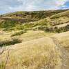
“A scenic and challenging route from the American Fork River to the Ridge Trail #157. ”


3.8
Miles6.1
KMSingletrack
 Difficult
Land Manager: USFS - Uinta, Wasatch & Cache National Forests Office
 Alter-Nate Loop
9.5 mi 15.4 km • 1,919' Up 584.95 m Up • 1,917' Down 584.35 m Down

 Orem, UT
Dog Lake
Orem, UT
Dog Lake
5.9 mi 9.5 km • 1,218' Up 371.18 m Up • 1,215' Down 370.2 m Down
Snyderv…, UT
Coyote/Jordanelle Ridge Loop
9.8 mi 15.8 km • 1,238' Up 377.34 m Up • 1,239' Down 377.77 m Down
 Park City Epic - IMBA EPIC
25.6 mi 41.2 km • 3,518' Up 1072.37 m Up • 3,575' Down 1089.63 m Down
Park City, UT
Mid Mountain Loop - IMBA EPIC
22.9 mi 36.8 km • 2,307' Up 703.06 m Up • 2,351' Down 716.44 m Down
Park City, UT
The UP Laps
6.9 mi 11.2 km • 1,110' Up 338.33 m Up • 1,109' Down 338.04 m Down
Summit…, UT


1 Comment