
 Continue with onX Maps
 Continue with Facebook


 Intermediate/Difficult


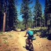
“A forest road that connects to the Cedar Flat Trail and the Fiberboard Freeway. ”


2.3
Miles3.8
KMDoubletrack
 Intermediate/Difficult
Local Club: Tahoe Area Mountain Biking Association (TAMBA)
Jan 30, 2024: TAMBA Trail Legends: Fish Family
Dec 11, 2023: TAMBA Trail Legends: John Clausen
Nov 9, 2023: Alpenglow Winter Speaker Series: Michelle Parker’s ‘A Shift in Perspective’
Land Manager: USFS - Lake Tahoe Basin Management Unit Office
 Antone Meadows loop
8.6 mi 13.8 km • 491' Up 149.79 m Up • 488' Down 148.73 m Down
Dollar…, CA
 Northstar at Tahoe Downhill #1 Boondocks
1.5 mi 2.3 km • 0' Up 0 m Up • 923' Down 281.41 m Down
Tahoe V…, CA
 Painted Rock Loop via Tahoe Rim Trail (TRT)
18.4 mi 29.6 km • 1,959' Up 597.17 m Up • 1,959' Down 597.07 m Down
Stanford Loop Trail to Twin Peaks
7.4 mi 11.9 km • 2,249' Up 685.46 m Up • 299' Down 91.21 m Down
Sunnysi…, CA
Tyrolean Downhill
4.5 mi 7.2 km • 70' Up 21.39 m Up • 1,793' Down 546.61 m Down
Incline…, NV
Rose to Toads
65.3 mi 105.0 km • 9,100' Up 2773.79 m Up • 11,390' Down 3471.72 m Down
Incline…, NV


0 Comments