
 Continue with onX Maps
 Continue with Facebook


 Intermediate


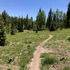
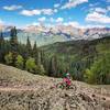
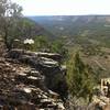
“A high country loop along the edge of Naturita Canyon. ”


4.5
Miles7.2
KMSingletrack


0 Comments