
 Continue with onX Maps
 Continue with Facebook


 Difficult

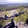
“Small rock and gravel singletrack at the bottom with larger rock obstacles up higher. ”


0.4
Miles0.6
KMSingletrack
 Difficult
Land Manager: Hanson-Larsen Memorial Park Foundation
 Hanson-Larsen Memorial Park Race Course
13.4 mi 21.5 km • 1,868' Up 569.38 m Up • 1,865' Down 568.55 m Down
 Victoria Lake Lollipop
9.3 mi 14.9 km • 1,000' Up 304.83 m Up • 1,004' Down 306.1 m Down
 Centennial Trail #89: Sheridan Lake to Pactola Reservoir
9.0 mi 14.5 km • 1,368' Up 417.03 m Up • 1,072' Down 326.82 m Down
 Deerfield Trail Ride
10.4 mi 16.8 km • 164' Up 50.07 m Up • 734' Down 223.78 m Down
Centennial Trail-Bulldog Climb
8.2 mi 13.3 km • 885' Up 269.88 m Up • 885' Down 269.72 m Down
Sturgis, SD
Mickelson: Deadwood to Edgemont
113.3 mi 182.3 km • 4,096' Up 1248.55 m Up • 5,234' Down 1595.21 m Down


0 Comments