
 Continue with onX Maps
 Continue with Facebook


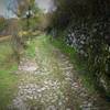
“Two steep and rocky steps, combined with a few flat sections through the meadows ”


1.6
Miles2.5
KMSingletrack

 Lago Vintage: Altissimo
15.7 mi 25.3 km • 2,594' Up 790.71 m Up • 7,433' Down 2265.7 m Down

 Monte Baldo Downhill
8.0 mi 12.9 km • 1,083' Up 329.99 m Up • 5,569' Down 1697.58 m Down
 Monte Velo - Naranch Trail Loop
17.8 mi 28.6 km • 3,947' Up 1203.18 m Up • 3,965' Down 1208.41 m Down
Lago Vintage: Bocca di Trat
23.9 mi 38.5 km • 6,084' Up 1854.26 m Up • 6,084' Down 1854.5 m Down
 Malga San Giovanni via Calvola
16.8 mi 27.0 km • 3,860' Up 1176.57 m Up • 3,865' Down 1178.02 m Down
Paradiso Loop - The Old Austrian Military Trail
13.3 mi 21.5 km • 3,137' Up 956.05 m Up • 3,145' Down 958.68 m Down


0 Comments