
 Continue with onX Maps
 Continue with Facebook


 Difficult

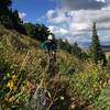
“Gorgeous views and lots of climbing! ”


6.7
Miles10.7
KMSingletrack
 Difficult
Local Club: Bonneville Shoreline Trail
Land Manager: Weber County Government, Ogden, UT - Parks
 North Ogden Bonneville Shoreline Loop
7.8 mi 12.6 km • 1,015' Up 309.31 m Up • 1,011' Down 308.06 m Down

 North Ogden Divide to Ben Lomond
16.3 mi 26.3 km • 3,755' Up 1144.48 m Up • 3,755' Down 1144.64 m Down
Liberty, UT
 XTERRA Triathlon Nationals: MTB Portion
15.7 mi 25.3 km • 3,230' Up 984.47 m Up • 1,697' Down 517.3 m Down
Wolf Creek, UT
North Fork Park Figure-Eight Ride
9.9 mi 16.0 km • 1,587' Up 483.68 m Up • 1,584' Down 482.67 m Down
 Eden Epic
46.2 mi 74.3 km • 8,271' Up 2520.87 m Up • 8,647' Down 2635.51 m Down
Liberty, UT
Antelope Island Figure 8
16.6 mi 26.7 km • 1,805' Up 550.2 m Up • 1,805' Down 550.27 m Down


2 Comments