MTB Project Logo

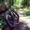
A flowy connector to the Hidden Lakes area.


Your Rating: Rating Rating Rating Rating Rating      Clear Rating
Your Difficulty:
Your Favorites: Add To-Do · Your List
Zoom in to see details
Map Key

0.5

Miles

0.7

KM

Singletrack

664' 202 m

High

653' 199 m

Low

6' 2 m

Up

13' 4 m

Down

1%

Avg Grade (0°)

3%

Max Grade (2°)

Dogs Leashed

E-Bikes Unknown

Please check hmba.org for current trail conditions.

This trail is shared with hikers and horses. Please be considerate of other users.

Description

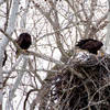
From the intersection with Upper Cottonwood and Lower Cottonwood, continue south along the old levee. The trail curves along the top of the levee to stay out of the wettest areas and ends at an intersection with an old gravel access road in the Hidden Lakes part of Southwestway Park. The gravel roads are within the park, so feel free to explore around the oxbow lakes in the area. It's a great area for wildlife viewing and fishing.

Contacts

Shared By:

Nate Hawkins

Trail Ratings

  2.5 from 4 votes

#34306

Overall
  2.5 from 4 votes
5 Star
0%
4 Star
0%
3 Star
75%
2 Star
0%
1 Star
25%
Trail Rankings

#234

in Indiana

#34,306

Overall
1 Views Last Month
400 Since Jun 23, 2015
Easy/Intermediate Easy/Intermediate

20%
20%
60%
0%
0%
0%

Photos

Log-ride
Aug 3, 2018 near Southport, IN
loading

Weather


Current Trail Conditions

Bad / Closed 12 days ago
Add Your Check-In

Check-Ins

Aug 5, 2021
Logan Hubbard
This is more of a cross-country trail that is easy to build up speed on
Nov 27, 2016
Kevin Whited
Welcome

Join the Community

Create your FREE account today!
Already have an account? Login to close this notice.

Get Started