MTB Project Logo

Tight singletrack along the river with a steep, punchy climb to finish.


Your Rating: Rating Rating Rating Rating Rating      Clear Rating
Your Difficulty:
Your Favorites: Add To-Do · Your List
Zoom in to see details
Map Key

0.4

Miles

0.7

KM

Singletrack

732' 223 m

High

653' 199 m

Low

108' 33 m

Up

39' 12 m

Down

6%

Avg Grade (4°)

21%

Max Grade (12°)

Dogs Leashed

E-Bikes Unknown

Please visit hmba.org to check trail status.

This trail is shared with hikers and horses, so please be considerate of other trail users.

Description

From the intersection with Cottonwood and Upper Cottonwood, return back to the north along the White River. Near the end of this trail, there is an unnamed spur that continues to follow the river on your right while Lower Cottonwood climbs steeply to the top of the river bluff.

Contacts

Shared By:

Nate Hawkins

Trail Ratings

  3.7 from 3 votes

#20705

Overall
  3.7 from 3 votes
5 Star
0%
4 Star
67%
3 Star
33%
2 Star
0%
1 Star
0%
Trail Rankings

#167

in Indiana

#20,705

Overall
1 Views Last Month
419 Since Jun 23, 2015
Intermediate/Difficult Intermediate/Difficult

0%
0%
33%
33%
33%
0%

Photos

Enjoy pleasant lake views from Lower Cottonwood.
Mar 19, 2017 near Southport, IN
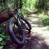
Log-ride
Aug 3, 2018 near Southport, IN

0 Comments

Weather


Current Trail Conditions

Bad / Closed 13 days ago
Add Your Check-In

Check-Ins

Aug 5, 2021
Logan Hubbard
Pretty steep climb
Jul 1, 2021
Andrew Hutchison
May 27, 2019
kelley Wagner
Oct 26, 2016
Daniel Stone
Almost made it up that climb this time. Should've down shifted sooner. Still made it up the powerline climb after, though. Great day for a ride. 0.5mi — 0h 10m
Welcome

Join the Community

Create your FREE account today!
Already have an account? Login to close this notice.

Get Started