
 Continue with onX Maps
 Continue with Facebook


 Difficult

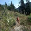
“A meadow and hot spring journey. ”


6.7
Miles10.8
KMSingletrack
 Difficult
Local Club: Southwest Idaho Mountain Bike Association
Land Manager: USFS - Boise National Forest Office
 Peace Creek Summit
15.7 mi 25.3 km • 2,484' Up 757.01 m Up • 2,484' Down 757 m Down

 Cascade, ID
Graham-Horse Heaven Loop
Cascade, ID
Graham-Horse Heaven Loop
54.6 mi 87.9 km • 7,240' Up 2206.72 m Up • 7,238' Down 2206.22 m Down
Idaho City, ID
 Airline Loop
22.1 mi 35.6 km • 3,251' Up 990.84 m Up • 3,246' Down 989.27 m Down
Idaho City, ID
Idaho Trail Segment 9
64.9 mi 104.4 km • 5,683' Up 1732.18 m Up • 5,420' Down 1652.12 m Down
Granite - Smith Traverse
21.9 mi 35.3 km • 3,610' Up 1100.39 m Up • 3,707' Down 1129.79 m Down
 Wash Creek Ridge Loop
11.3 mi 18.3 km • 1,333' Up 406.22 m Up • 1,332' Down 406.09 m Down
Idaho City, ID


0 Comments