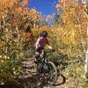
“A rutted and rocky doubletrack connecting Magnolia Drive to the Dot Trails. ”
1.2
Miles2.0
KMDoubletrack

Local Club: Boulder Mountainbike Alliance
Feb 22, 2024: Join us in Shaping Colorado’s Outdoor Future
Feb 1, 2024: Eagle-Sage Trail Closures
Jan 31, 2024: Coalton Trail Reopening Feb. 1
Land Manager: USFS - Arapaho National Forests - Clear Creek Ranger District
 Rhythm & Blues
10.3 mi 16.6 km • 825' Up 251.57 m Up • 825' Down 251.49 m Down


 Nederland, CO
 The Cougar Slayer
69.6 mi 112.0 km • 8,965' Up 2732.51 m Up • 11,815' Down 3601.28 m Down


 Nederland, CO
 West Magnolia Tour
8.0 mi 12.8 km • 590' Up 179.88 m Up • 608' Down 185.45 m Down


 Nederland, CO
 Switzerland Trail Gold Hill Road Loop
25.3 mi 40.7 km • 1,949' Up 593.94 m Up • 1,948' Down 593.78 m Down


 Nederland, CO
 Sourdough - Eldora - Nederland Loop
26.7 mi 43.0 km • 2,883' Up 878.83 m Up • 2,899' Down 883.5 m Down


 Nederland, CO
 Betasso Preserve
7.1 mi 11.5 km • 768' Up 234.03 m Up • 759' Down 231.27 m Down


 Boulder, CO


1 Comment