
 Continue with onX Maps
 Continue with Facebook


 Intermediate

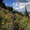
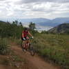
“A wide, purpose-built trail which ascends from Art Nord to Green Pond. ”


3.2
Miles5.1
KMSingletrack
 Intermediate
Land Manager: USFS - Uinta, Wasatch & Cache National Forests Office
 XTERRA Triathlon Nationals: MTB Portion
15.7 mi 25.3 km • 3,230' Up 984.47 m Up • 1,697' Down 517.3 m Down
 Wolf Creek, UT
 Sardine Peak
7.7 mi 12.4 km • 1,210' Up 368.94 m Up • 1,209' Down 368.64 m Down
 Ogden, UT
 North Ogden Divide to Ben Lomond
16.3 mi 26.3 km • 3,755' Up 1144.48 m Up • 3,755' Down 1144.64 m Down
Liberty, UT
2022 El Doce Course
16.2 mi 26.0 km • 1,737' Up 529.58 m Up • 1,736' Down 529.09 m Down
Wolf Creek, UT
North Ogden Bonneville Shoreline Loop
7.8 mi 12.6 km • 1,015' Up 309.31 m Up • 1,011' Down 308.06 m Down
North Fork Park Figure-Eight Ride
9.9 mi 16.0 km • 1,587' Up 483.68 m Up • 1,584' Down 482.67 m Down


0 Comments