
 Continue with onX Maps
 Continue with Facebook


 Difficult

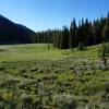
“A primitive and scenic singletrack ride. ”


7.6
Miles12.3
KMSingletrack
 Difficult
Local Club: Wood River Trails Coalition
Land Manager: USFS - Sawtooth National Forest - Ketchum Ranger District
 Adams Gulch Loop/Griffin Butte Loop
6.8 mi 10.9 km • 1,269' Up 386.64 m Up • 1,262' Down 384.73 m Down

 Adam's Gulch Beginner Loop
6.1 mi 9.8 km • 687' Up 209.3 m Up • 692' Down 211.04 m Down
 Sun Valley, ID
 The Big Smokey Loop
57.3 mi 92.2 km • 5,111' Up 1557.96 m Up • 5,108' Down 1557.02 m Down
Galena Grinder - IMBA EPIC
25.6 mi 41.1 km • 3,056' Up 931.47 m Up • 3,047' Down 928.59 m Down
Sun Valley, ID
Idaho Trail Segment 4
41.0 mi 66.0 km • 6,538' Up 1992.76 m Up • 4,146' Down 1263.56 m Down
Fairfield, ID
Big Bowery Loop
36.4 mi 58.6 km • 4,382' Up 1335.59 m Up • 4,381' Down 1335.44 m Down


0 Comments