
 Continue with onX Maps
 Continue with Facebook


 Intermediate


 Intermediate
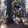
Land Manager: USFS - Eldorado National Forest Office
 Xmas Valley Epic
17.5 mi 28.2 km • 2,685' Up 818.24 m Up • 2,704' Down 824.08 m Down
South L…, CA
Tahoe Rim Trail to Christmas Valley Trail
8.9 mi 14.3 km • 1,554' Up 473.66 m Up • 1,543' Down 470.45 m Down
South L…, CA
 Sidewinder Corral Ride
9.2 mi 14.7 km • 1,388' Up 423.1 m Up • 1,392' Down 424.23 m Down
South L…, CA
Tour of Angora Ridge/Tahoe Mountain Loop
12.4 mi 20.0 km • 1,749' Up 533.06 m Up • 1,747' Down 532.61 m Down
South L…, CA
 Barker Pass Loop
8.9 mi 14.3 km • 1,417' Up 431.9 m Up • 1,419' Down 432.39 m Down
Sorenson Loop
8.4 mi 13.5 km • 1,329' Up 405.04 m Up • 1,330' Down 405.24 m Down


0 Comments