
 Continue with onX Maps
 Continue with Facebook


 Intermediate

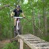
“A short trail that connects to Liberty's outer trails. ”


0.6
Miles0.9
KMSingletrack
 Intermediate
Local Club: Greater Lynchburg Off-Road Cyclists
Land Manager: Liberty University
 Enduro Route
8.4 mi 13.6 km • 1,111' Up 338.7 m Up • 1,111' Down 338.73 m Down

 Lake Trail Loop
8.6 mi 13.9 km • 936' Up 285.34 m Up • 935' Down 285.07 m Down
 2018 Commonwealth Games MTB Race Course
6.4 mi 10.3 km • 873' Up 266.14 m Up • 873' Down 266.21 m Down
 Fat Tire Frenzy Race Course
7.1 mi 11.4 km • 516' Up 157.4 m Up • 518' Down 157.89 m Down
James River State Park Complete Loop
14.0 mi 22.5 km • 1,531' Up 466.75 m Up • 1,532' Down 466.92 m Down
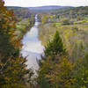
Smith Mountain Lake State Park
8.8 mi 14.2 km • 895' Up 272.94 m Up • 894' Down 272.42 m Down


0 Comments