
 Continue with onX Maps
 Continue with Facebook


 Difficult

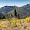
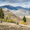
“A nice in climb and descent in the shadow of Smoky Dome. ”


10.0
Miles16.0
KMSingletrack
 Difficult
Local Club: Wood River Trails Coalition
Land Manager: USFS - Sawtooth National Forest - Ketchum Ranger District
 Lime Creek Loop
27.4 mi 44.2 km • 3,374' Up 1028.42 m Up • 3,375' Down 1028.77 m Down


 Big Smoky Trail
18.4 mi 29.6 km • 234' Up 71.4 m Up • 2,936' Down 894.77 m Down
Greenhorn Gulch Adventure
22.6 mi 36.3 km • 4,192' Up 1277.73 m Up • 4,205' Down 1281.57 m Down
 Adams Gulch Loop/Griffin Butte Loop
6.8 mi 10.9 km • 1,269' Up 386.64 m Up • 1,262' Down 384.73 m Down
Adams Gulch Intermediate Loop
11.0 mi 17.7 km • 1,923' Up 585.98 m Up • 1,910' Down 582.26 m Down
 Adam's Gulch Beginner Loop
6.1 mi 9.8 km • 687' Up 209.3 m Up • 692' Down 211.04 m Down
Sun Valley, ID


0 Comments