
 Continue with onX Maps
 Sign in with Facebook


 Difficult


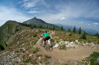
“Steep connector to Pinkham Butte from N. Fork Asotin Creek and Asotin Creek Trail #3125. ”


1.2
Miles1.9
KMSingletrack


2 Comments