Dogs Off-leash

E-Bikes
Not Allowed

11/2020 Update: Parking is limited at the Peak-to-Peak trailhead and riders should park at the RTD Park and Ride in Nederland, the parking at Nederland High School (when school is not in session), or the central West Mag lot 1 mile down Haul Road. This route has been updated to start from the center lot.
Overview
This ride takes in most of the newly rebuilt close-to-town trails in the West Mag area profiled in the
Rhythm & Blues featured ride and then adds one of the best climbs and descents in the West Mag area.
This is a more rugged and remote trail experience that requires an adventurous spirit, plenty of extra food and water, and a willingness to get lost and find yourself again. Much of this trail system will be updated, the intersections made more intuitive, and the eroded sections of trail rerouted or hardened due to the Boulder Ranger District's Magnolia Non-Motorized Trails Plan - so get out there to experience the "old school" Mag backcountry experience while it still exists.
What comes in the future is likely to be more navigable, less eroded, and more pleasant for the average mountain biker. Note: the West Magnolia trails area has many short trails that are disjointed by brief segments of road which can be disorienting. Do not despair if you make a wrong turn. There are as many good ways to do this ride as there are opinions on the internet. The key features of this ride are the
Lost Meadow Trail #355 /
Rocks and Roots /
School Bus #929 link up to get the big climb and descent. The rest can be improvised.
Need to Know
This loop takes you far into the backcountry and away from civilization. This area is a maze of trails and old roads, you should expect to get lost and find yourself again. Come prepared with a map, plenty of water, and a sandwich. If you don't like exploring, don't do this ride without someone who knows the area well.
Description
This ride can be done from the Observatory Trailhead, the RTD Park-n-Ride in Nederland, the parking at Nederland High School (when school is not in session), the parking at the West Magnolia Trailhead on the Peak-to-Peak Highway (very limited parking). This route starts from the Observatory trailhead 1 mile down Haul Road, but you can modify these directions to work for the other parking areas.
From the parking lot, head east (the way you drove in), cross the road and start up the trail. At the first intersection, stay left to stay on
Handshake. Follow
Handshake to the four way intersection with
Aspen Alley Trail #342A - make a right on
Aspen Alley Trail #342A and head downhill. Cross
Sugar Magnolia #926. Aspen Alley will spit you out at the far end of Haul Road - cross the road and begin climbing
Lookout Trail #926.
A couple hundred feet after your crest the top of the hill, there will be a right turn onto
Hobbit. This new trail segment was completed in 2020. While many riders prefer the south-to-north direction, it rides well this direction, too. You'll climb a bit (look for the optional Engine Slab feature 1/3 of a mile in) and you'll be rewarded with some bumps and berms at the end where you connect at a K intersection (you'll take the closest right). You are now heading away from civilization. If you thought the core West Mag areas were difficult to navigate, reconsider heading up here. If you are looking for some adventure, let's start the climb!
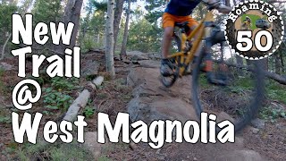
This trail is variously called
Lost Meadow Trail #355 ,
Hobbit 3.5, or
Rocks and Roots. After about a mile in the forest, the trail opens up into a pretty meadow. You'll pass a few trails along the way, but don't take them. They are mostly descents that will either be a horrible climb, or take you back downhill. Feel free to explore this area if you have an adventurous spirit. Many of these trails will be decommissioned as part of the Magnolia Non-Motorized Trails Plan, so enjoy them while they still exist - we hope to see equally awesome trails developed in the future that do not cross private property or go through sensitive habitat.
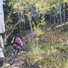
At the western edge of the meadow, there is a 4x4 road the enters from the north. Continue up
Rocks and Roots to the southwest crossing a small stream and tackling many exposed roots and steep eroded tread. You'll come across several intersecting roads, and you'll usually do well by taking the one that looks most well worn, and, sadly, the steepest option. Doing so will eventually take you to a spot where the road levels out and spits you out on the 503 road. Go uphill on this road for about a quarter mile then turn left on the
109 road for about 0.4 miles. Look to your left for a short climb through some aspens - this is easy to miss, so don't get excited and start heading downhill on the road! There are some "No Trespassing" signs that can be confusing - they are there to remind you to stay on the trail.
From here, take a left and head east onto a short singletrack climb that is the
School Bus #929 trail. A couple hundred feet later you start to descend. This is a long, and gnarly descent. If you like going fast through chunder, you'll love the upper parts of this descent. The legendary bus rests about 2/3 down a bit off the trail. At the bottom, you'll come to a T-intersection with the
Hobbit trail - turn right (downhill). Stay on
Hobbit through several road crossings to
Re-Root #927 .
Continue on
Re-Root #927 (crossing Haul Road) to the intersection with
Aspen Alley Trail #342A where you'll take a left. Climb until it tops out in a meadow and begin descending. There is one trail intersection where you'll want to bear right and stay on
Aspen Alley Trail #342A and another to stay left. The lower part of the trail is extremely fun - with rollers, jumps, and berms with a number of alternate lines with features. At the bottom of the berms you'll hit
Handshake again. Make a left and come back the way you started to get back to the trailhead.
History & Background
The Boulder Mountainbike Alliance (BMA) has been working in this area for a very long time, from getting the original social trails legitimized when the U.S. Forest Service (USFS) was considering what to do about them back in 2003 to advocating for a dramatic expansion of the legal trail system when the USFS decided to tackle the issue of social trail proliferation in a process that came to a close in 2016.
The USFS recently approved the Magnolia Non-Motorized Trails Project, and BMA is helping to secure funds to help the USFS implement that project. This long-term involvement of BMA with the USFS has allowed for some very creative and progressive trail design and construction on the near town trails. In the coming years, this work will continue to head uphill to address many of the trails on this ride. Look for significant improvements in this ride in the years ahead. The Nederland Area Trails Organization (NATO) also partners on this project.
Contacts
Shared By:
Wendy Sweet
with improvements
by Jason Vogel
and 1 other

 Continue with onX Maps
 Continue with Facebook


 Intermediate/Difficult


 West Mag to Eldora and Back
 Nederland, CO
 Sherwood From Nederland
 Sourdough - Eldora - Nederland Loop
 Walker Ranch


9 Comments