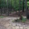
“Flat to mildly hilly single and doubletrack that creates a 6 mile loop. ”
5.2
Miles8.4
KMSingletrack

Land Manager: Maryland Dept Natural Resources
 Rosaryville SP - Perimeter Trail and Inner Loop
10.6 mi 17.0 km • 795' Up 242.38 m Up • 795' Down 242.26 m Down


 Marlton, MD
 Cosca Park
8.7 mi 14.0 km • 474' Up 144.46 m Up • 472' Down 143.92 m Down


 Clinton, MD
 Fort Dupont Park
9.9 mi 15.9 km • 583' Up 177.7 m Up • 583' Down 177.66 m Down


 Washing…, DC
 Laurel Hill
10.7 mi 17.3 km • 586' Up 178.64 m Up • 586' Down 178.71 m Down


 Lorton, VA
 Burke Lake and Lake Mercer Grand Tour
15.7 mi 25.3 km • 519' Up 158.22 m Up • 522' Down 159.18 m Down


 Burke, VA
 NoVa Epic- Northern Tour
46.6 mi 74.9 km • 1,959' Up 597.12 m Up • 1,963' Down 598.42 m Down


 Reston, VA


1 Comment