Dogs Unknown

E-Bikes
Unknown

Make sure to give the trail a couple of days to dry after a heavy rainfall. Much of this trail system is in and around marshy areas.
Overview
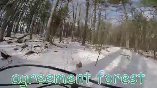
This trail system is one of those places that you go to get lost. With no markers or trail names, it can lead to some "wrong" turns, which essentially lead to more great trails. All singletrack trails pretty much return to the main access roads.
Make sure to have the
MTB Project mobile app to help find your locations if you happen to get lost. Also, make sure to check out
HAFTA's website and get the membership - it's the main way they're able to keep these trails in such great shape!
Description
If you can find the trailhead you should be OK to find your way around the trails. If you are coming from the 401, head north on Guelph Line towards the Mohawk Racetrack. The parking will be across the street from the track and will be marked by a green address sign - 9475. Many riders will park in the northeast corner of the race track parking lot. We have a great relationship with them, so make sure to be respectful if you choose to park here.
From the trailhead, there are 2 ways to start and both will eventually link up. If you head towards the north side of the parking, you'll find some singletrack to get started on (my recommendation). You'll know you're going the right way when you start a quick little climb up some singletrack.
At the first option, stay left on
Fence Line Trail and you'll meet up with the
Boundary Trail. There is another junction, stay left again and enjoy Whale Bone! You are going to continue on BT and, after a nice little rocky section, you have the option to ride
Rock Wall or skip it - I recommend testing your skills on this great feature. After
Rock Wall, you'll want to turn left and ride
Zanadu, which will eventually lead back to BT. Go left on
Boundary Trail and continue on until you reach the access trail.
Almost immediately after you hit the access road, hang a left on
Bat Boxes. There's an option on BB to go left or right - left is more difficult, but both are rideable and fun. At the next junction turn right and after the bridge, look to the left and hop back on some singletrack for a nice little rocky/flowy section called
I Will Allow It. When you meet back up with the main road, follow this for a couple of kilometers. It's not all wide and boring. There are some interesting sections along here as well. You'll eventually come to a spot where 4 trails meet, take the one to the left. Follow this for a while until you come back out to the logging road.
Here you stay right and follow this road for about 1 km. Just as the logging road veers to the left, you'll see a trail to the right - definitely take this. After a section of two small bridges and a rock bridge, keep left at the split or depending on your time, you can head back at this point (keep right instead of left) or you can head up the logging road towards 6th Line and meet up with
Chain Reaction.
The biggest challenge of this system is NOT doing one more section. It is a fabulous place to waste a day getting lost.
History & Background
In southern Ontario, many tracts of forest were established through agreements between the provincial government and another party, normally a municipal government or Conservation Authority, usually on municipally owned lands, and often with the financial or managerial support of the province (i.e., the Ministry of Natural Resources). Typically, agreement forests were started to reclaim land that had been cleared for agriculture but which was not being used nor was ideally suited for this activity. Some of these lands were abandoned and had associated environmental problems, such as soil erosion and flooding. According to MNR, the Agreement Forest Program included management planning, marking, marketing, and other duties to ensure effective rehabilitation of the lands.
Contacts
Shared By:
Trevor Miller

 Continue with onX Maps
 Sign in with Facebook


 Difficult

 4.3 (7)


0 Comments