MTB Project Logo

This rugged singletrack has a natural surface.

G E

Your Rating: Rating Rating Rating Rating Rating      Clear Rating
Your Difficulty:
Your Favorites: Add To-Do · Your List
Zoom in to see details
Map Key

3.0

Miles

4.8

KM

Singletrack

960' 293 m

High

831' 253 m

Low

269' 82 m

Up

270' 82 m

Down

3%

Avg Grade (2°)

12%

Max Grade (7°)

Dogs Leashed

E-Bikes Allowed

Certain portions of the trail system are closed during Spring and Fall hunting seasons. The closure dates are posted and closed sections clearly marked. There is still plenty of trail for a good ride during these closures. It is also discouraged to ride directly after rain.

Trails are open from dawn to dusk.

Description

The WRV trail system consists of four loops - Red Loop, Blue Loop, Green Loop, and Orange Loop, as well as several connectors and cross trails. All in all, if memory serves me correctly, there is over 12 miles of trail in this system.

The Red trail is approximately 3.1 miles long with some fairly mild to intermediate climbs, a couple (typically mostly dry) creek crossings, nice dirt, and, of course, some good old Ozarks rock. There are a couple "Advanced" cut-through trails if you want to mix it up a bit.

The Blue Loop connects to the Red Loop on one end and Orange Loop on the other. Clockwise on the Blue Loop is a nice ride with a nice flowy section near Lake Taneycomo, then proceeding to a steady and somewhat difficult climb. Counter-clockwise on the Blue Loop is more difficult due to a fairly long, steep climb at first. Afterwards, you are rewarded with a long, flowing downhill and a few small, steeper climbs leading back to Red.

The Green Loop and Orange Loop are both shorter with a little different terrain style than the Blue and Red. They are also steeper rides with more climbing in shorter distances. Green has its own trailhead and connects to Orange, which then has a connector to Blue, so you can ride the whole trail system no matter which trailhead you start from.

All in all, this is a nice trail system that typically has a decent dirt pack instead of the gravelly marbles you might find typically in the Ozarks on more heavily-used trails. There are no man-made features on the trail and the terrain is pretty much all natural with no significant drops, jumps, or large obstacles. Pretty much all trails are fairly "experienced" beginner friendly but offer fun/challenging climbing and downhill sections for more advanced riders.

The land itself, I believe, is a joint project between the State Parks System and the Army Corps of Engineers who, back in the 1950's, used the land to quarry and transport materials for Table Rock Dam. Along the trail, you can find remnants of this use from old cable, large concrete anchors, various scrap, and quarried areas. There is also an old shack/homestead and cellar on the Green loop that is mildly interesting.

Contacts

Shared By:

G E

Trail Ratings

  4.3 from 26 votes

#727

Overall
  4.3 from 26 votes
5 Star
38%
4 Star
50%
3 Star
12%
2 Star
0%
1 Star
0%
Trail Rankings

#11

in Missouri

#727

Overall
23 Views Last Month
6,264 Since Jan 2, 2014
Intermediate Intermediate

0%
4%
75%
8%
13%
0%

Photos

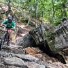
Tree'd the bike on the red loop.
Jul 14, 2016 near Hollister, MO
loading

Weather


Current Trail Conditions

Unknown
Add Your Check-In

Check-Ins

Dec 25, 2023
Josh Garber
Jul 25, 2023
John Fieber
A great time. A few fallen trees over the trail, no trouble getting around them. Blue makes sense, there are some challenging climbs.
Jul 26, 2022
Luke Krantz
Sep 2, 2021
McKenzie Benkner
Jul 27, 2021
Joey S
7/27 - Full system minus green loop & connector 5 2.5mi — 1h 00m
Oct 17, 2020
Joseph Rich
Oct 10, 2020
Travis Leaming
Aug 23, 2020
Dane Iwata
Welcome

Join the Community

Create your FREE account today!
Already have an account? Login to close this notice.

Get Started