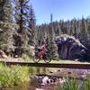
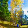
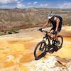
“A fairly technical doubletrack that then flattens out near the top. ”
2.6
Miles4.2
KMDoubletrack

Local Club: Los Alamos Singletrack Association
Land Manager: USFS - Santa Fe National Forest Office
 NICA XC Course: Pedal Pajarito
3.2 mi 5.2 km • 550' Up 167.57 m Up • 545' Down 166.01 m Down


 Los Alamos, NM
 Perimeter to Walnut Canyon
6.9 mi 11.1 km • 640' Up 195.15 m Up • 635' Down 193.61 m Down


 Los Alamos, NM
 Las Conchas-Los Griegos Traverse
27.2 mi 43.9 km • 3,852' Up 1173.96 m Up • 3,866' Down 1178.42 m Down


 Los Alamos, NM
 Calaveras Canyon
13.8 mi 22.2 km • 1,086' Up 331.09 m Up • 1,092' Down 332.71 m Down


 Santa T…, NM
 Winsor South Eight
15.4 mi 24.8 km • 2,705' Up 824.62 m Up • 2,712' Down 826.56 m Down


 Santa Fe, NM
 White Ridge Trail System - Main Loop
8.4 mi 13.5 km • 831' Up 253.34 m Up • 825' Down 251.4 m Down


 Jemez P…, NM


0 Comments