
 Continue with onX Maps
 Continue with Facebook


 Intermediate

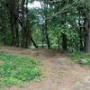
“Bypass option for the upper section of the Friends Trail. ”


0.5
Miles0.8
KMSingletrack
 Intermediate
Land Manager: Massachusetts State Parks - Department of Conservation
 Beaver Brook Loop
8.1 mi 13.0 km • 554' Up 168.85 m Up • 572' Down 174.33 m Down

 Yudicky Loop
11.1 mi 17.9 km • 839' Up 255.69 m Up • 843' Down 257.06 m Down
 Mass Central Rail Trail - West Boylston to Holden
5.1 mi 8.1 km • 381' Up 116.14 m Up • 142' Down 43.38 m Down
 Outer Loop Network
6.5 mi 10.5 km • 394' Up 120 m Up • 364' Down 111.09 m Down
Russel Mill Tour
4.9 mi 7.9 km • 305' Up 93.08 m Up • 305' Down 92.89 m Down
Chelmsford, MA
Callahan Tour
9.4 mi 15.1 km • 773' Up 235.68 m Up • 774' Down 235.93 m Down


0 Comments