MTB Project Logo

A fun singletrack trail in either direction with an opportunity for a dip in an alpine lake.


Your Rating: Rating Rating Rating Rating Rating      Clear Rating
Your Difficulty:
Your Favorites: Add To-Do · Your List
Zoom in to see details
Map Key

4.1

Miles

6.6

KM

Singletrack

10,237' 3,120 m

High

9,653' 2,942 m

Low

311' 95 m

Up

658' 201 m

Down

5%

Avg Grade (3°)

14%

Max Grade (8°)

Dogs Unknown

E-Bikes Unknown

Not rideable until the snow has melted, which could be into early June. If you're driving to the eastern trailhead, low clearance vehicles are not recommended after the turn onto Lost Lake Spur. No problems driving to the western trailhead.

Description

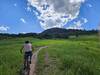
Starting at about 9 miles up from the valley floor of North Frontage Road, Lost Lake Trail is out there. It can be ridden in either direction, or as an out-and-back. Parking is available at either end of the trail.

If riding east to west, you could connect to Buffehr Creek Trail descent. If riding west to east, you could connect to 
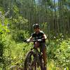
Son of Middle Creek. It's not particularly difficult in either direction, and riding east to west, there is only 1 short/steep climb. The trail does require skill with negotiating exposed roots and loose rocks riding in either direction.

The trail is obvious and easy to follow, except for one area (see info icon): If riding east to west, once you see the lake, follow the trail off to the right with the lake on your left. If riding west to east, once you see the lake, follow the trail about 1/4 of the way around the lake or about 1/4 mile, then veer to your left with the lake at your back.

Ride east to west if you want (this direction is mapped here):
- more challenging climbing with a few hike-a-bike sections
- a super fun, fast and steady descent
- to connect to Buffehr Creek Trail

Ride west to east if you want:
- to climb steadily rather than steeply
- to connect to Son of Middle Creek

Or ride out and back from either direction!

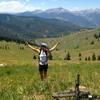
3 stars. The trail itself is excellent in either direction. Getting to it is either a lot of fire road climbing or driving to enjoy about 4 miles of singletrack.

Contacts

Shared By:

Jason Lampenrider

Trail Ratings

  2.9 from 11 votes

#11

in Vail

#23202

Overall
  2.9 from 11 votes
5 Star
0%
4 Star
18%
3 Star
64%
2 Star
9%
1 Star
9%
Trail Rankings

#11

in Vail

#2,183

in Colorado

#23,202

Overall
1 Views Last Month
4,082 Since Jul 13, 2013
Difficult Difficult

0%
0%
10%
0%
90%
0%

Photos

Views of Mt of the Holy Cross
Jul 18, 2020 near Vail, CO
Typical of this trail: some exposed roots loose rocks
Jul 13, 2013 near Vail, CO
The trail is not particularly clear at this point. From this viewpoint, it comes from behind and continues to the right.
Jul 13, 2013 near Vail, CO
Nice open view at this section
Jul 13, 2013 near Vail, CO
The descent when heading east to west
Jul 13, 2013 near Vail, CO
Lost Lake
May 28, 2013 near Vail, CO
loading

Weather


Current Trail Conditions

Unknown
Add Your Check-In

Check-Ins

Jul 18, 2020
Nick Wilder
Nov 2, 2017
Ryan Gross
Sep 4, 2016
Tom Wagner
Sep 29, 2013
Nick Wilder
Sep 4, 2013
Gustav Wold
7.2mi — 1h 24m
Aug 29, 2013
Gustav Wold
Started west end, went around and down fire road to closure and back. 15mi
Jul 12, 2013
Jason Lampenrider
Welcome

Join the Community

Create your FREE account today!
Already have an account? Login to close this notice.

Get Started