
 Continue with onX Maps


Rate Photo


Daniel Almquist
May 11, 2022
near Cascade-Chipita Park,
CO
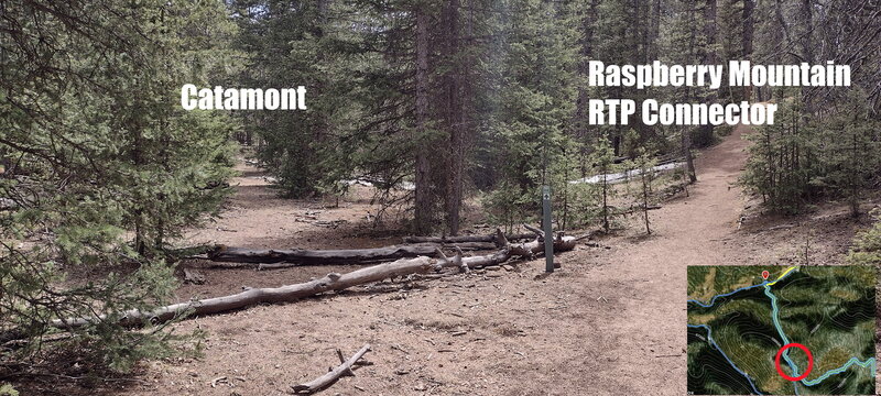
“The south entrance to this trail is easy to miss. This photo is facing roughly SE. The Ring the Peak trail signs want you to go to the right, but to get on this trail you need to go left over the logs.”


 Catamount to Paul's DH

 Ring the Peak 2019
 Raspberry Mountain RTP Conn…


0 Comments