Continue with onX Maps
 Sign in with Facebook


Eastern Ontario
 ON
ON- Eastern Ontario


Recommended Routes in Eastern Ontario - 3
MTB Project is built by riders like you. Add Your Recommended Routes


Eastern Ontario Biking
- 236 Miles 380 Kilometers of Trail
- 3 Recommended Routes
- 11
Easy Trails

- 24
Intermediate Trails

- 16
Difficult Trails

MTB Project is built by riders like you. Share
what you know about this area!
Areas Within Eastern Ontario
Weather Averages
|
High
|
Low
|
Precip
|
Days w/
|
| J | F | M | A | M | J | J | A | S | O | N | D |
Trails in Eastern Ontario - 48
MTB Project is built by riders like you. Add Your Trails
3.3
mi
5.3
km
#1Oriole Lake Loop
 Difficult
Calabogie, ON

|
Difficult
|
Calabogie, ON |
1
|
|
0.6
mi
1.0
km
#2Little Pine Path
 Very Difficult
Calabogie, ON
|
Very Difficult
|
Calabogie, ON |
1
|
|
|
0.7
mi
1.1
km
#3Hotel California
Difficult
Wakefield, QC
|
Difficult
|
Wakefield, QC |
1
|
|
|
0.2
mi
0.3
km
#4Family Jewel
Very Difficult
Wakefield, QC
|
Very Difficult
|
Wakefield, QC |
1
|
|
|
1.4
mi
2.2
km
#5Lager
Very Difficult
Wakefield, QC

|
Very Difficult
|
Wakefield, QC |
2
|
|
3.2
mi
5.2
km
#6Manitou Mountain Trail
 Intermediate/Difficult
Calabogie, ON
|
Intermediate/Difficult
|
Calabogie, ON |
2
|
|
|
1.9
mi
3.0
km
#7PWT
Difficult
Bells Corners, ON
|
Difficult
|
Bells Corners, ON |
2
|
|
0.7
mi
1.1
km
#8Baseline
 Easy
Easy
Wakefield, QC
|
Easy
|
Wakefield, QC |
1
|
|
|
2.1
mi
3.4
km
#9Ridgeline Trail
Difficult
Calabogie, ON
|
Difficult
|
Calabogie, ON |
1
|
|
|
2.6
mi
4.2
km
#10Chuck-A-Moon
Difficult
Beachburg, ON
|
Difficult
|
Beachburg, ON |
1
|
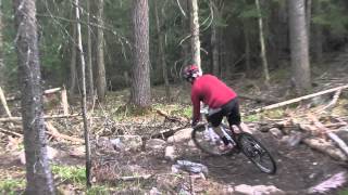
Photos of Eastern Ontario - 18
MTB Project is built by riders like you. Add Your Photos