Continue with onX Maps
 Continue with Facebook


Río Grande del Norte National Monument
 NM
NM- North Central New Mexico
- Río Grande del Norte National Monument


Recommended Routes in Río Grande del Norte National Monument - 6
MTB Project is built by riders like you. Add Your Recommended Routes


 Easy/Intermediate
Rift Valley Trail
12.6 mi 20.4 km • 723' Up 220.22 m Up • 723' Down 220.36 m Down


 Intermediate/Difficult
The Vistas de Questa - West Trailhead
10.1 mi 16.2 km • 1,267' Up 386.23 m Up • 1,272' Down 387.62 m Down
 Easy/Intermediate
East Rim and Ute Mountain Ride
30.0 mi 48.3 km • 680' Up 207.12 m Up • 680' Down 207.14 m Down
 Intermediate/Difficult
Questa - San Cristobal Loop
25.2 mi 40.5 km • 2,801' Up 853.73 m Up • 2,803' Down 854.23 m Down


Río Grande del Norte National Monument Biking
- 174 Miles 280 Kilometers of Trail
- 6 Recommended Routes
- 25
Easy Trails

- 32
Intermediate Trails

- 9
Difficult Trails

Areas Within Río Grande del Norte National Monument
Weather Averages
|
High
|
Low
|
Precip
|
Days w/
|
| J | F | M | A | M | J | J | A | S | O | N | D |
Trails in Río Grande del Norte National Monument - 60
MTB Project is built by riders like you. Add Your Trails
9.1
mi
14.7
km
#1West Rim Doubletrack
 Easy
Easy
Questa, NM
|
Easy
|
Questa, NM |
1
|
|
|
6.6
mi
10.7
km
#2West Rim Trail: South
Easy
Arroyo Hondo, NM
|
Easy
|
Arroyo Hondo, NM |
1
|
|
2.6
mi
4.2
km
#3TP 247
 Difficult
Questa, NM
|
Difficult
|
Questa, NM |
1
|
|
|
2.5
mi
4.0
km
#4TP 251
Difficult
Questa, NM
|
Difficult
|
Questa, NM |
1
|
|
2.9
mi
4.7
km
#5Southwest Ute Road
 Intermediate
Questa, NM
|
Intermediate
|
Questa, NM |
1
|
|
|
0.6
mi
1.0
km
#6Guadalupe Mountain Road
Easy
Questa, NM
|
Easy
|
Questa, NM |
1
|
|
|
2.1
mi
3.4
km
#7West Rim Trail: Viewpoint Loop
Easy
Questa, NM
|
Easy
|
Questa, NM |
1
|
|
|
1.5
mi
2.4
km
#8TP 249
Difficult
Questa, NM
|
Difficult
|
Questa, NM |
1
|
|
|
2.4
mi
3.8
km
#9Ranch Road Connector
Easy
Questa, NM
|
Easy
|
Questa, NM |
1
|
|
|
1.5
mi
2.4
km
#10West Rim Trail: North
Easy
Arroyo Hondo, NM
|
Easy
|
Arroyo Hondo, NM |
1
|
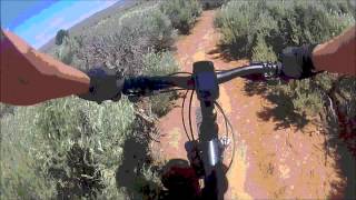
Photos of Río Grande del Norte National Monument - 91
MTB Project is built by riders like you. Add Your Photos