Dogs Unknown

E-Bikes
Unknown

Trails generally have enough snow melted away to start riding in late April and are usually snowed in by November. Cattle, horses, and wildlife are present in the area. Temporary trail closures can be expected from time to time. Keep all gates closed.
Overview
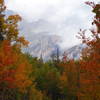
Wildflowers adorn this scenic loop through well-managed forest throughout the spring, summer and fall. Elk, mule deer, and turkey abound along relatively easy singletrack. Brockover Mesa's minor slope gains little elevation for a trail in this region, leaving energy to explore long distances on smooth, wandering trails that are very beginner-friendly.
Need to Know
For more Pagosa Springs trail info check out PagosaTrails.net or "Pagosa Trails" on Facebook. Expect frequent encounters with hikers and runners near the trailheads, and with cows farther out. There are many fence crossings, but they are all bike friendly - as in, you don't even have to get off the bike!
Description
Starting at the main trailhead on Country Road 600, start riding on the doubletrack. At an intersection with the
Turkey Springs trail, turn right. This trail wanders through pine forest, touches occasional exposed rock surface, spirits a meadow here and there, and brushes the aspens. Pretty much everything is downhill from this trail. Keep an eye out for
Gopher to join from the left.
Gopher rolls off past Brockover Road making a fun and fast descent along a tributary and into Peterson Gulch on singletrack that ranges from long swooping turns to tight skirts around stumps and between bushes. Just as one begins to feel guilty for all that downhill and starts to wonder how much climbing they'll have to do next, the trail quickly departs the canyon with a surprising, short but steep, technical section. Then, it's quickly back to meandering singletrack atop the mesa through Pine forest to join up with
Lower Rim Trail.
Lower Rim skirts the west side of Martinez Cr. Canyon and features more rocky and steep sections than what has been encountered so far. Such remains the ride as a very brief jaunt on
Creek. After a right turn, you'll quickly come to another right turn which keeps you on
Upper Rim, back to the starting point of the ride. There are some minor climbs near this end of the ride, but fret not, for it is short-lived and the price to be paid for all the fun downhill in the canyons! Besides, the views over the canyon are worth it.
Take
Upper Rim to join with
Newt Jack. Two minor rocky sections at the beginning may have you thinking twice if you're a beginner, but don't get discouraged! Just hike a bike for 10 feet and don't worry about it again for 15 solid miles!
Newt Jack is probably the least desirable of the trails encountered on the loop, with its rocky, former two-track character. That said, it is short lived and crosses a nice little creek setting.
Leave the rocks and erosion behind and quickly forget them on the superb, smooth singletrack of
Catamount (313). At an intersection with
Park Ave, turn right to stay on
Catamount. Arrive back at an intersection with
Turkey Springs and turn right, re-tracing your tracks back to the trailhead.
History & Background
These trails were unofficial until 2012 when the local forest service mapped, signed, and sanctioned them as part of its
Turkey Springs Management Plan. Now enjoy well-maintained singletrack with nearly limitless opportunities.
Contacts
Shared By:
Robert Stump
with improvements
by Dan Hickstein

 Continue with onX Maps
 Continue with Facebook


 Intermediate

 Turkey Springs Lollipop

 Horizon/Lange Canyon Loop

 FSR 523/524
 Colorado Trail: The Entire MTB Route - IMBA EPIC


 Bad / Closed


4 Comments