
 Continue with onX Maps
 Continue with Facebook


 Intermediate/Difficult

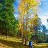
“This trail connects Forest Road 144 (31 Mile Road) with the Valle Caldera. ”


3.4
Miles5.5
KMDoubletrack
 Intermediate/Difficult
Land Manager: National Park Service - Valles Caldera National Preserve
 Valles Caldera: NW Side
40.1 mi 64.6 km • 2,352' Up 716.97 m Up • 2,352' Down 716.89 m Down
 Calaveras Canyon
13.8 mi 22.2 km • 1,086' Up 331.09 m Up • 1,092' Down 332.71 m Down

 San Antonio Creek Route
18.9 mi 30.4 km • 1,127' Up 343.51 m Up • 1,127' Down 343.61 m Down
 Los Alalmos Pipe Line Guaje
16.8 mi 27.1 km • 2,894' Up 882.04 m Up • 3,019' Down 920.09 m Down
 Quemazon - Guaje Ridge - Cabra - Perimeter Loop
18.9 mi 30.4 km • 3,101' Up 945.28 m Up • 3,102' Down 945.37 m Down
Vallecitos to El Rito Route
16.2 mi 26.0 km • 1,092' Up 332.77 m Up • 1,599' Down 487.45 m Down
Arroyo…, NM


0 Comments