
 Continue with onX Maps
 Continue with Facebook


 Intermediate

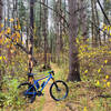
“Northeast corner of the lake along Que Dam Rd. Climb from the north end with a rocky section at the crest. ”


2.3
Miles3.6
KMSingletrack
 Intermediate
Local Club: LHORBA - Laurel Highlands On & Off Road Bicycling Association
Land Manager: Cambria Somerset Authority (CSA)
 Que Trail - Full Loop
16.1 mi 26.0 km • 1,129' Up 344.01 m Up • 1,129' Down 344.16 m Down

 Jerome, PA
 Rich's Recommended Ride
13.1 mi 21.2 km • 914' Up 278.63 m Up • 913' Down 278.25 m Down
Highland Intro
4.8 mi 7.7 km • 329' Up 100.14 m Up • 329' Down 100.3 m Down
 Best of Laurel (Advanced)
20.4 mi 32.9 km • 1,128' Up 343.7 m Up • 1,126' Down 343.33 m Down
Boswell, PA
 Intro to Laurel
14.3 mi 23.0 km • 545' Up 166.21 m Up • 545' Down 166.12 m Down
LHORBA BKSP Intermediate: "10 Mile Downhill"
8.8 mi 14.1 km • 190' Up 57.84 m Up • 1,643' Down 500.91 m Down


1 Comment