
 Continue with onX Maps
 Continue with Facebook


 Intermediate

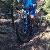
“A scenic forest road through the middle of one of the Carson National Forest's most remote areas. ”


9.2
Miles14.8
KMDoubletrack
 Intermediate
Land Manager: USFS - Carson National Forest
 Hopewell Gold
11.5 mi 18.5 km • 1,286' Up 392.04 m Up • 1,288' Down 392.62 m Down
 Continental Divide Trail: New Mexico Section 29 Out-and-Back
33.1 mi 53.3 km • 4,051' Up 1234.75 m Up • 4,051' Down 1234.85 m Down
The Vistas de Questa - West Trailhead
10.1 mi 16.2 km • 1,267' Up 386.23 m Up • 1,272' Down 387.62 m Down
 Horsethief Mesa Loop
12.7 mi 20.4 km • 943' Up 287.37 m Up • 939' Down 286.28 m Down
Questa - San Cristobal Loop
25.2 mi 40.5 km • 2,801' Up 853.73 m Up • 2,803' Down 854.23 m Down
 CDT South: HWY 17 to NM Border
6.0 mi 9.6 km • 795' Up 242.22 m Up • 795' Down 242.36 m Down


0 Comments