MTB Project Logo

A detour from the GR6 crest route that takes in Les Baux, Château d'Estoublon and the crags of Vallon de la Lèque.


Your Rating: Rating Rating Rating Rating Rating      Clear Rating
Your Difficulty:
Your Favorites: Add To-Do · Your List
Zoom in to see details
Map Key

7.5

Miles

12.1

KM

Doubletrack

748' 228 m

High

168' 51 m

Low

737' 225 m

Up

410' 125 m

Down

3%

Avg Grade (2°)

11%

Max Grade (6°)

Dogs Unknown

E-Bikes Unknown

Like most of the south of France, Les Alpilles can close for fire danger in the summer.

Need to Know

Both Les Baux and the Château provide an excellent opportunity for a delightful patio lunch: c'mon, skip the Clif bars today... you're in France!

The canal path between Vallon de la Léque and Chemin d'Auge can have tall grass that may harbor ticks. If conditions look questionable, there's a parallel doubletrack along the edge of the garrigue scrub just north of the canal.

Description

From the Grande Randonnée 6: Ners to Aureille on the crest, dropping down usually means finding yourself on the major paved roads that transverse, and encircle the Alpilles massif.

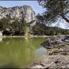
Instead, this mapped route leads you off the GR6 at the Citerne No. 45, down gravel fire roads through the Vallon de la Léque. This is a popular climbing area, with moderate crags on your right. At the informal parking area, turn right and follow the road a few hundred yards to where you can start to see hooped greenhouses ahead on your right. Turn left and follow the canal path until you reach the paved Chemin d'Auge. This road marks the west boundary of the Domaine d'Estoublon. This estate is famous for olive oil and wine tastings, and as the setting for a popular 1970's-1990's history-based TV series, "Les Gens de Mogador".

Sadly, the estate has decided to fence the entire massive property, so if you want to visit, you'll have to turn right and follow the road down to the D17 to enter at their official gate. Or, if you want to skip it, turn left and follow the pavement back up into the hills. From here, it's probably best to just direct you to follow the map carefully so you don't get stuck on private property behind a locked gate.

The faint tracks lead you onto an unpaved neighborhood lane that eventually turns paved. Either follow the pavement all the way to the D27, turn left, and pedal up the busy road filled with tourists looking for parking. Or use the mapped route for a quieter detour if you aren't planning to visit the hilltop fortified village of Les Baux today (a big mistake if you've never been).

From Les Baux, if it's not too busy you can pedal up the D27 to the pass, the reward for which is either to rejoin the GR6, or stay on the D27 for a fun, swoopy descent of the north slope of Las Alpilles that is a blast even if you aren't a fan of road riding. If you descend this way, at the bottom of the hill turn right/left onto the unpaved canal path, or continue north to reach the new paved Voie Verte between Tarascon and St.-Remy-en-Provence for car-free pedaling to your destination (or to close the loop).

Shared By:

F Felix

Trail Ratings

  4.0 from 1 vote

#16369

Overall
  4.0 from 1 vote
5 Star
0%
4 Star
100%
3 Star
0%
2 Star
0%
1 Star
0%
Trail Rankings

#28

in France

#16,369

Overall
1 Views Last Month
64 Since Apr 11, 2019
Intermediate Intermediate

0%
0%
100%
0%
0%
0%

0 Comments

Current Trail Conditions

Unknown
Add Your Check-In

Check-Ins

none
Welcome

Join the Community

Create your FREE account today!
Already have an account? Login to close this notice.

Get Started