MTB Project Logo

This route goes across the northwest side of the Rio Grande in a remote yet surprisingly scenic high desert ride.


Your Rating: Rating Rating Rating Rating Rating      Clear Rating
Your Difficulty:
Your Favorites: Add To-Do · Your List
Zoom in to see details
Map Key

19.0

Miles

30.6

KM

Doubletrack

7,665' 2,336 m

High

7,072' 2,156 m

Low

713' 217 m

Up

302' 92 m

Down

1%

Avg Grade (1°)

5%

Max Grade (3°)

Dogs Unknown

E-Bikes Unknown

Features Commonly Bikepacked

Need to Know

Once you pass the Rio Grande, water is extremely scarce. Once you return to the John Dunn Bridge, relax in the water and cool off from the ride. Midtown Lounge in Arroyo Hondo has good food and drinks.

Description

This 25-mile route crosses the Rio Grande, travels north on the west side of the gorge past three cerros and one brushy mountain. This high desert ride provides ample opportunities for bikepacking and further exploration of this largely unexplored region on New Mexico.

Take in the stunning cerros jutting out of the desert and all the strange geology happening around you. Explore Brushy Mountain and find the unique white sands pouring out of the south side.

This route begins at either Arroyo Hondo or on the west side of the John Dunn Bridge if you want to avoid pavement. From Arroyo Hondo, ride west on County Road B-007 and cross the John Dunn Bridge spanning the Rio Grande. Climb out of the Rio Grande and take the second right leading to several houses.

Once on this main road, stay on it for the duration of the ride. After 13 miles, you'll start to see Cerro Montoso to the left. Cerro Montoso has lots of bikepacking locations to explore and camp at. Keep going north on the main road until you see the other cerros coming out of the horizon.

Keep going straight until you get to Cerro Chiflo. From Cerro Chiflo, travel east along the north-facing side of the hill until you reach the Rio Grande Gorge opposite of Sheep's Crossing in Wild Rivers National Monument. Once you reach the end, make your way back or explore the countless other roads in the area. I recommend exploring Brushy Mountain to find the dry oasis on the south side of the mountain.

Contacts

Shared By:

DeArmond Lopez

Trail Ratings

  3.3 from 3 votes

#23150

Overall
  3.3 from 3 votes
5 Star
33%
4 Star
33%
3 Star
0%
2 Star
0%
1 Star
33%
Trail Rankings

#536

in New Mexico

#23,150

Overall
2 Views Last Month
829 Since Sep 20, 2018
Intermediate/Difficult Intermediate/Difficult

0%
0%
50%
0%
50%
0%

Photos

West side of Sheeps Crossing.
Sep 30, 2018 near Questa, NM
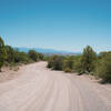
View from the road.
Sep 30, 2018 near Questa, NM
Cerro Chiflo.
Sep 30, 2018 near Questa, NM
The high desert.
Sep 30, 2018 near Questa, NM

0 Comments

Weather


Current Trail Conditions

Unknown
Add Your Check-In

Check-Ins

Oct 17, 2019
Sally Owen
Welcome

Join the Community

Create your FREE account today!
Already have an account? Login to close this notice.

Get Started