
 Continue with onX Maps
 Continue with Facebook


 Easy
Easy

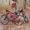
“This is a Forest Service road that helps access the Turkey Creek Trail. ”


1.7
Miles2.8
KMDoubletrack
 Easy
Easy
Local Club: SORBA - Central Savannah River Area
Land Manager: USFS - Francis Marion & Sumter National Forest Office
 Brown Wave & Skinny
12.2 mi 19.6 km • 580' Up 176.73 m Up • 578' Down 176.21 m Down

 Martinez, GA
 Mistletoe State Park
6.7 mi 10.8 km • 647' Up 197.18 m Up • 658' Down 200.58 m Down
Long Cane Horse Trail Figure 8
31.7 mi 51.1 km • 2,547' Up 776.38 m Up • 2,587' Down 788.49 m Down


0 Comments