
 Continue with onX Maps
 Continue with Facebook


 Easy
Easy


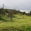
“A north-south cross-town trail following a flood control channel. ”


1.0
Miles1.7
KMDoubletrack
 Easy
Easy
Land Manager: City of Yucaipa - Recreation
 Oakmont Park
3.9 mi 6.3 km • 405' Up 123.59 m Up • 435' Down 132.53 m Down
 Calimesa, CA
Jedi Tree and Back
Calimesa, CA
Jedi Tree and Back
4.2 mi 6.7 km • 484' Up 147.51 m Up • 497' Down 151.54 m Down
Loma Linda, CA
 Lord of the Ridges Loop
6.2 mi 9.9 km • 790' Up 240.84 m Up • 793' Down 241.82 m Down
NICA SoCal HS Cycling League: Beach to Boulders Race Course (2019)
5.7 mi 9.1 km • 421' Up 128.42 m Up • 423' Down 128.96 m Down
Santa Ana River Trail (SART) 2E03 Shuttle
13.7 mi 22.1 km • 1,300' Up 396.14 m Up • 1,782' Down 543.24 m Down
Big Bea…, CA
 John Bull Loop
14.8 mi 23.8 km • 1,368' Up 417.09 m Up • 1,376' Down 419.34 m Down


0 Comments