
 Continue with onX Maps
 Continue with Facebook


 Easy/Intermediate

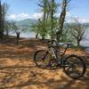
“The western remnants of Canada Creek Road. ”


1.2
Miles2.0
KMDoubletrack
 Easy/Intermediate
Land Manager: USFS - Chattahoochee-Oconee National Forest
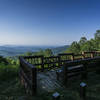
 Steer Mountain
15.4 mi 24.9 km • 1,652' Up 503.38 m Up • 1,652' Down 503.6 m Down

 Dahlonega, GA
 4x4 (Long Branch / Green Mountain / Flat Creek)
11.7 mi 18.9 km • 2,006' Up 611.55 m Up • 2,006' Down 611.42 m Down
Blue Ridge, GA
 Cartecay Loop
6.1 mi 9.8 km • 624' Up 190.33 m Up • 624' Down 190.29 m Down
Georgia Nuclear Aircraft Laboratory
22.4 mi 36.1 km • 2,043' Up 622.67 m Up • 2,034' Down 619.86 m Down
Jackrabbit Mountain
11.3 mi 18.1 km • 693' Up 211.12 m Up • 692' Down 211.07 m Down
Hayesville, NC
Cohutta Death March
68.9 mi 110.9 km • 7,609' Up 2319.3 m Up • 7,616' Down 2321.3 m Down
McCaysv…, GA


0 Comments