
 Continue with onX Maps
 Continue with Facebook


 Very Difficult

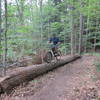
“An excellent downhill! ”


0.5
Miles0.8
KMSingletrack
 Very Difficult
Land Manager: Town of Vestal, NY - Parks
 Jones Park
3.2 mi 5.1 km • 529' Up 161.15 m Up • 528' Down 160.99 m Down

 Page Brook Loop
6.5 mi 10.5 km • 487' Up 148.42 m Up • 468' Down 142.73 m Down
 Chenang…, NY
Oakley Corners State Forest Trail Tour
Chenang…, NY
Oakley Corners State Forest Trail Tour
15.2 mi 24.5 km • 1,568' Up 477.89 m Up • 1,551' Down 472.87 m Down
 Jenksville State Forest Tour
11.8 mi 19.0 km • 1,000' Up 304.94 m Up • 1,011' Down 308.29 m Down
Shindagin Hollow Outer Loop
14.8 mi 23.9 km • 1,539' Up 469.07 m Up • 1,538' Down 468.87 m Down
Shindagin Hollow West Trail Loop
6.7 mi 10.7 km • 553' Up 168.59 m Up • 553' Down 168.54 m Down
Dryden, NY


0 Comments