MTB Project Logo

A full loop with an epic ridgeline with a killer descent.


Your Rating: Rating Rating Rating Rating Rating      Clear Rating
Your Difficulty:
Your Favorites: Add To-Do · Your List
Zoom in to see details
Map Key

26.2

Miles

42.1

KM

45%

Singletrack

3,278' 999 m

High

1,365' 416 m

Low

3,282' 1,000 m

Up

3,277' 999 m

Down

5%

Avg Grade (3°)

31%

Max Grade (17°)

Dogs Unknown

E-Bikes Unknown

none

Overview

Enjoy an all day outing on one of the epic ridgeline rides in the Blue Ridge Mountains. You'll start with several miles of climbing along roads before reaching the Whetstone Ridge Trail #523. Once the singletrack starts there are no bailouts and the ridgeline is very remote. Be prepared for serious ups and downs and some very technical sections. There's also a lot of rolling smooth fast stuff along the descent back to the start.

Need to Know

  • There are no services available anywhere along the route so come prepared with ample supplies.
  • As mapped the ride starts along Irish Creek Road before taking Nettle Creek Road to reach the Blue Ridge Parkway. Alternatively riders can stick to Irish Creek Road almost to the start of the trail.

Description

Start the ride with a mellow ascent on Irish Creek Road. At 2.6 miles either take a right on Nettle Creek Road (as mapped) or keep straight. After a few miles on Nettle Creek Road it connects to the Blue Ridge Parkway. There are a few more miles of climbing before a nice long descent continues all the way to the start of the singletrack.

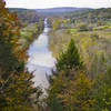
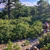
The Whetstone Ridge Trail #523 is a great backcountry trail that's generally easy to follow. The ridgeline has many views in all directions. Expect numerous techy sections, hard climbs, great singletrack, and an awesome descent at the end that heads back to the road.

No maps are totally accurate of this area as a lot of the trails are old hunting paths. The turn down the switchbacks is marked but finding it on maps is tough. There are other ways down and they pretty much take you back to the bottom road but this trail is the best way down.

Part of the appeal of this trail and the surrounding area is that this ain’t Disneyland. In the backcountry, the element of 'figure it out yourself' always exists. This ridgeline is, however, a gem to be shared!

The end of the singletrack conveniently deposits riders back at where you left your car.

Contacts

Shared By:

Joseph Rowe III

Trail Ratings

  4.6 from 7 votes

#1696

Overall
  4.6 from 7 votes
5 Star
57%
4 Star
43%
3 Star
0%
2 Star
0%
1 Star
0%
Recommended Route Rankings

#42

in Virginia

#1,696

Overall
16 Views Last Month
4,767 Since Sep 10, 2017
Difficult Difficult

0%
0%
0%
0%
100%
0%

Photos

Looking NW
Sep 10, 2017 near East Le…, VA
Awesome views
Sep 10, 2017 near East Le…, VA
More fine trail
Sep 10, 2017 near East Le…, VA
Looking south towards the last hurdle.
Sep 10, 2017 near East Le…, VA
Looking SE
Sep 10, 2017 near East Le…, VA
Looking west towards Marlbrook
Sep 10, 2017 near East Le…, VA
loading

Weather


Current Trail Conditions

Unknown
Add Your Check-In

Check-Ins

Jun 26, 2021
Miguel Soto
26.2mi — 8h 11m
May 15, 2019
Luke McCleary
Jan 26, 2018
Jack Dichiara
Took the left to climb Irish Creek road. Whetstone Ridge is nuts! So sick 22.5mi
Welcome

Join the Community

Create your FREE account today!
Already have an account? Login to close this notice.

Get Started