
 Continue with onX Maps
 Continue with Facebook


 Intermediate


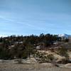
“A forest service that descends north of Schubarth Road (307). ”


4.0
Miles6.4
KMDoubletrack
 Intermediate
Land Manager: USFS - Pikes Peak Ranger District
 Rampart Reservoir Trail
14.2 mi 22.9 km • 1,034' Up 315.02 m Up • 1,027' Down 313.06 m Down
Blodgett Fun
11.8 mi 19.0 km • 2,496' Up 760.65 m Up • 2,509' Down 764.6 m Down
Ute Valley Loop
4.0 mi 6.5 km • 285' Up 87.02 m Up • 277' Down 84.52 m Down
 Ute Valley Six Mile Loop
5.8 mi 9.3 km • 578' Up 176.04 m Up • 579' Down 176.35 m Down
 Colorad…, CO
 Pulpit Rock Beginner Tour
8.2 mi 13.3 km • 820' Up 249.99 m Up • 827' Down 251.98 m Down
D-Loop #4
10.1 mi 16.3 km • 1,103' Up 336.29 m Up • 1,093' Down 333.09 m Down


0 Comments