
 Continue with onX Maps
 Continue with Facebook


 Intermediate

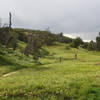
“A ridgeline descent away from the Razor Ridge. ”


0.9
Miles1.4
KMDoubletrack
 Intermediate
Land Manager: City of Loma Linda - Public Works
 Lord of the Ridges Loop
6.2 mi 9.9 km • 790' Up 240.84 m Up • 793' Down 241.82 m Down

 Oakmont Park
3.9 mi 6.3 km • 405' Up 123.59 m Up • 435' Down 132.53 m Down
 Calimesa, CA
Southridge XC Course
Calimesa, CA
Southridge XC Course
5.8 mi 9.3 km • 710' Up 216.56 m Up • 708' Down 215.71 m Down
 Mountain Home Creek - SART - Thomas Hunting Grounds Loop
20.4 mi 32.9 km • 3,075' Up 937.39 m Up • 3,061' Down 932.99 m Down
Loch Leven Loop
21.2 mi 34.1 km • 3,012' Up 918.12 m Up • 3,012' Down 917.99 m Down
Santa Ana River Trail (SART) 2E03 Shuttle
13.7 mi 22.1 km • 1,300' Up 396.14 m Up • 1,782' Down 543.24 m Down
Big Bea…, CA


 All Clear


0 Comments