
 Continue with onX Maps
 Continue with Facebook


 Difficult

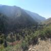
“A climbing trail from Albion Basin Road to Ridge Trail #157. ”


1.5
Miles2.4
KMDoubletrack
 Difficult
Land Manager: Alta Ski Area
 Snowbird Climb to Tram & Big Mountain Downhill
14.3 mi 23.0 km • 3,025' Up 922.09 m Up • 3,043' Down 927.59 m Down

 Alta, UT
Mill D to Desolation Lake
Alta, UT
Mill D to Desolation Lake
7.7 mi 12.3 km • 1,905' Up 580.73 m Up • 1,904' Down 580.36 m Down
Alta, UT
 Quarry Trail
6.7 mi 10.7 km • 1,142' Up 347.95 m Up • 1,141' Down 347.84 m Down
Jenni's/Tommy's/Mojave/Mid Mountain/CMG
10.5 mi 17.0 km • 1,789' Up 545.34 m Up • 1,785' Down 544.14 m Down
Park City, UT
 Park City Epic - IMBA EPIC
25.6 mi 41.2 km • 3,518' Up 1072.37 m Up • 3,575' Down 1089.63 m Down
Park City, UT
Summit Park Loop
5.1 mi 8.2 km • 815' Up 248.38 m Up • 832' Down 253.45 m Down
Summit…, UT


0 Comments