
 Continue with onX Maps
 Continue with Facebook


 Easy
Easy

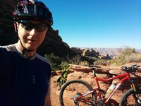
“A motorized road used to access Spring Canyon trails. Leave gates as you found them. ”


2.9
Miles4.7
KMDoubletrack
 Easy
Easy
 Buzzard Gulch Loop
11.6 mi 18.7 km • 1,050' Up 320.17 m Up • 1,058' Down 322.39 m Down

 Dry Creek Canyon Trails
13.7 mi 22.1 km • 1,622' Up 494.42 m Up • 1,616' Down 492.46 m Down
Sunset Rocks
6.7 mi 10.8 km • 1,048' Up 319.53 m Up • 1,063' Down 324.03 m Down

 Buck and Aspen Combo
17.6 mi 28.2 km • 1,858' Up 566.19 m Up • 1,853' Down 564.81 m Down
Sidewinder Trail
18.6 mi 29.9 km • 2,864' Up 872.99 m Up • 2,048' Down 624.14 m Down
Orchard…, CO
Colorado Trail: The Entire MTB Route - IMBA EPIC
549.3 mi 884.0 km • 71,117' Up 21676.5 m Up • 69,664' Down 21233.6 m Down
Roxboro…, CO


 All Clear


2 Comments