
 Continue with onX Maps
 Continue with Facebook


 Difficult

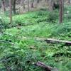
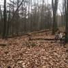
“A fast descent to Laurel Run Rd full of loose rocks and a creek crossing at the very end. ”


0.6
Miles1.0
KMSingletrack
 Difficult
Local Club: Nittany Mountain Biking Association
Land Manager: PA DCNR - Main Office
 Roth Rock Tour
26.6 mi 42.8 km • 2,692' Up 820.38 m Up • 2,694' Down 821.05 m Down

 Rothrock TrailMix - IMBA EPIC
36.3 mi 58.4 km • 4,220' Up 1286.26 m Up • 4,215' Down 1284.59 m Down
 Boalsburg, PA
Rothrock TrailMix Short Course
Boalsburg, PA
Rothrock TrailMix Short Course
18.7 mi 30.1 km • 2,203' Up 671.51 m Up • 2,204' Down 671.73 m Down
Boalsburg, PA
 State College Gap Loop (Musser Shingletown)
15.6 mi 25.2 km • 1,305' Up 397.79 m Up • 1,297' Down 395.3 m Down
Cooper's Quick Loop
10.7 mi 17.3 km • 1,255' Up 382.43 m Up • 1,264' Down 385.18 m Down
Belleville, PA
Greenwood Furnace 13
13.3 mi 21.5 km • 1,512' Up 460.81 m Up • 1,512' Down 460.74 m Down


0 Comments