
 Continue with onX Maps
 Continue with Facebook


 Intermediate/Difficult

“A 3.5 mile descent from Timberline Drive to Whites Creek Park. ”


3.6
Miles5.8
KMSingletrack
 Intermediate/Difficult
Land Manager: Washoe County Regional Parks and Open Space
 Ballardini Ranch Park
2.4 mi 3.8 km • 254' Up 77.31 m Up • 266' Down 81.2 m Down


 Tahoe Rim & Flume Trail via Tahoe Meadows - IMBA EPIC
24.6 mi 39.6 km • 1,455' Up 443.45 m Up • 3,861' Down 1176.83 m Down
Incline…, NV
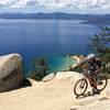
 TRT-Flume-Chimney Beach Exit
19.6 mi 31.6 km • 1,119' Up 341.13 m Up • 3,360' Down 1024.21 m Down
Incline…, NV
Tyrolean Downhill
4.5 mi 7.2 km • 70' Up 21.39 m Up • 1,793' Down 546.61 m Down
Incline…, NV
Peavine Challenge Long XC Course
24.1 mi 38.8 km • 3,018' Up 919.97 m Up • 3,019' Down 920.06 m Down
Reno, NV
Ash Canyon Trails
6.4 mi 10.2 km • 895' Up 272.89 m Up • 895' Down 272.74 m Down
Carson…, NV


 Minor Issues


0 Comments