
 Continue with onX Maps
 Continue with Facebook


 Difficult

“A tightly switchbacked climb from the canyon floor. ”


1.8
Miles2.8
KMDoubletrack
 Difficult
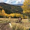
 Abajo Loop: Spring Creek to Robertson Pasture
14.7 mi 23.6 km • 2,544' Up 775.31 m Up • 2,545' Down 775.67 m Down


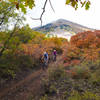
 Wagonwheel to Bulldog
8.7 mi 13.9 km • 283' Up 86.39 m Up • 1,948' Down 593.76 m Down
Lockhart Basin
44.3 mi 71.3 km • 2,366' Up 721.05 m Up • 2,520' Down 768.03 m Down
Moab, UT
Hotel Rock
13.6 mi 21.8 km • 1,380' Up 420.49 m Up • 1,379' Down 420.47 m Down
Canyon Rims-Lockhart Basin Loop
120.1 mi 193.3 km • 5,342' Up 1628.31 m Up • 5,294' Down 1613.7 m Down
Bikepacking: Moab to Boulder Town
294.3 mi 473.6 km • 16,628' Up 5068.07 m Up • 14,007' Down 4269.41 m Down


0 Comments