
 Continue with onX Maps
 Continue with Facebook


 Intermediate


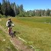
“A pretty, easy backcountry OHV route with nice meadows. ”


1.9
Miles3.0
KMDoubletrack
 Intermediate
Land Manager: USFS - Lake Tahoe Basin Management Unit Office
 Stanford Loop Trail to Twin Peaks
7.4 mi 11.9 km • 2,249' Up 685.46 m Up • 299' Down 91.21 m Down
 Sunnysi…, CA
Page Meadows Loop
Sunnysi…, CA
Page Meadows Loop
13.2 mi 21.3 km • 1,171' Up 356.84 m Up • 1,171' Down 356.88 m Down
Sunnysi…, CA
 Antone Meadows loop
8.6 mi 13.8 km • 491' Up 149.79 m Up • 488' Down 148.73 m Down
Dollar…, CA
 Tahoe Rim: Spooner to Town
17.7 mi 28.5 km • 2,127' Up 648.28 m Up • 2,994' Down 912.68 m Down
Indian…, NV
 Commemorative Overland Emigrant Trail
15.4 mi 24.8 km • 829' Up 252.59 m Up • 1,073' Down 327.02 m Down
Truckee, CA
Fallen Leaf Lake North Shore Lollipop
4.5 mi 7.3 km • 257' Up 78.38 m Up • 257' Down 78.35 m Down


0 Comments