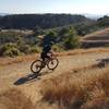
“A paved path from the marina and main parking lot. ”
1.8
Miles3.0
KMPaved Path

Land Manager: East Bay Regional Park District (CA)
 Lake Chabot Grand Loop
13.0 mi 21.0 km • 1,273' Up 387.88 m Up • 1,281' Down 390.48 m Down


 Ashland, CA
 Redtail-Towhee Trails Loop
15.6 mi 25.1 km • 1,971' Up 600.74 m Up • 1,972' Down 600.92 m Down


 Castro…, CA
 Big Trees Loop
3.4 mi 5.4 km • 390' Up 118.83 m Up • 390' Down 118.95 m Down


 Oakland, CA
 Joaquin Miller - Best of Oakland
10.0 mi 16.1 km • 1,104' Up 336.64 m Up • 1,159' Down 353.39 m Down


 Oakland, CA
 Creek Loop
6.8 mi 11.0 km • 777' Up 236.78 m Up • 779' Down 237.49 m Down


 Diablo, CA
 Joaquin Down, Up, and Out (auto free)
19.2 mi 30.9 km • 2,126' Up 647.87 m Up • 2,275' Down 693.3 m Down


 Oakland, CA


0 Comments