
 Continue with onX Maps
 Continue with Facebook


 Intermediate
Intermediate
Intermediate
 Intermediate
Local Club: Greater Clemson Mountain Bikers Club
Land Manager: Clemson Experimental Forest Operations
 Waterfall Area
5.0 mi 8.0 km • 450' Up 137.18 m Up • 452' Down 137.76 m Down

 Tour of Issaqueena
10.3 mi 16.6 km • 1,131' Up 344.76 m Up • 1,130' Down 344.37 m Down
 Tiger Rag Loop
9.6 mi 15.4 km • 960' Up 292.51 m Up • 954' Down 290.79 m Down
Fant's Grove Perimeter Loop
20.3 mi 32.6 km • 1,985' Up 605.17 m Up • 1,985' Down 604.98 m Down
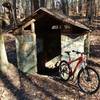
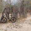
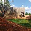
Town Creek Bike Park
0.8 mi 1.3 km • 29' Up 8.75 m Up • 29' Down 8.76 m Down
Paris Mountain State Park
11.5 mi 18.6 km • 1,338' Up 407.71 m Up • 1,337' Down 407.56 m Down
 Wade Ha…, SC


2 Comments